Is Vancouver Safe in 2026? A Local's Take on Stats vs. Street Reality
- Cindy Peterson

- Jan 3
- 5 min read

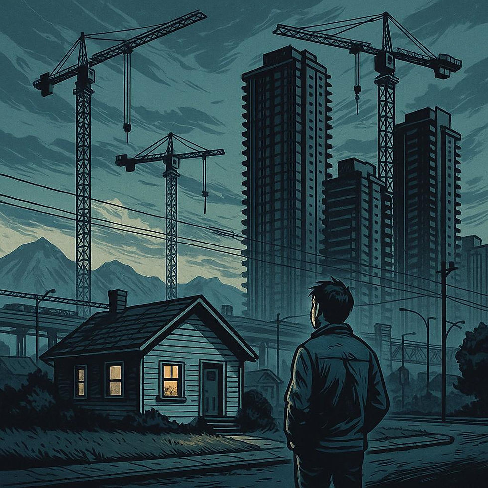
Depending on who you ask, Vancouver is either a shining jewel of the West Coast or a slow-motion car crash in expensive yoga pants. Both people are right.
We're living in two different versions of the same city. In one version, the one the police and the Mayor like to talk about, violent crime is at a 23-year low.
But then there’s the other version. The one where you see a guy having a screaming match with a mailbox at 10:00 AM. The one where 55% of us are genuinely afraid to get on the Skytrain, and where a family festival in April becomes a mass casualty site because of a "random" vehicle attack.
So which version is real?
Most of those huge drops (like the 44% drop in robberies) happened in the Downtown Eastside because of a massive $5 million police surge called Task Force Barrage.
Critics (and some news reports from late 2025) argue that the city is "cooking the stats" by claiming these neighborhood-specific drops are "citywide."

Yes - Vancouver Is Safer in 2026 According to Stats
VPD and StatsCan data show violent crime sitting at 20-year lows citywide. But Downtown and transit hubs are legitimately more chaotic because of exploding homelessness (up 9% recently) and street disorder that hits those specific spots hardest.
These are the "improvements" Vancouver Police Department and Statistics Canada trends point to:
Violent crime reached a 20-year low in early 2025, with assaults and robberies at record quarterly lows.
Compared to the early 2000s, violent crime rates are about 50% lower; property crimes like vehicle break-ins have also dropped significantly since 2020.
Nationally, Vancouver's violent crime severity fell faster than the Canadian average through the 2010s.
Official crime data shows the city is less violent overall than it was 10–20 years ago, with recent reports citing the lowest levels since 2002. But rising homelessness and visible crises in certain areas create real fears that the averages don't fully reflect. Both are true, and understanding that gap is key.
Citywide Picture (The "Safe" Stats) | Downtown/Transit Reality (The Fear) |
Violent crime down 11% in 2025 vs 2024 | Homelessness doubled since 2020, tents everywhere |
Assaults/robberies at record lows since 2002 | Assaults/sexual offences up 7-25% in hotspots |
50% lower than early 2000s rates | Homeless individuals victimized 10x more, mostly unreported |
The simple explanation? Crime dropped more in residential suburbs than downtown, which absorbed the post-pandemic homelessness crisis. Your SkyTrain commute feels dangerous because those specific blocks are riskier—not because you're imagining it.
Polls prove this split: 68% feel safe in their own neighborhood at night, but 55% fear violence on transit where encampments and disorder concentrate. Stats say "safe on average." Streets say "danger downtown." Both true.
Why Crime Stats Say Safe But Downtown Feels Sketchy
Violent Crime: Rates are historically low and stable over five years. Serious assaults on tourists remain rare—no true "no-go" zones like some global cities.
Property Crime: Main issue is car break-ins and bike thefts—lock up valuables and use secure parking.
Downtown Eastside (DTES): Around Main and Hastings, expect homelessness, open drug use, and discomfort. Passersby are usually fine if avoiding engagement, but skip it at night.
Which Neighborhoods Are Safe in 2026?
Here's my rule of thumb: Vancouver is safer where people live, riskier where people pass through. Don't know what I mean?
Dunbar-Southlands: Quiet streets, predictable routines, little reason for chaos to linger. The kind of place where nothing happens, and that is the point!
West Point Grey: Residential area. Extremely wealthy and very safe.
Kerrisdale: Affluent, orderly, and watched over, formally and informally. Disorder does not survive long before someone notices.
Shaughnessy and South Cambie: Wide streets, low foot traffic, minimal exposure to transit churn. These neighbourhoods absorb little of the city’s stress.
Large parts of Kitsilano: Life here is local. You are more likely to trip over a yoga mat than a crisis.
Riskier Neighborhoods in Vancouver
These are not places people settle into. They are places people cycle through, often under strain.
Downtown Eastside

This area generates the highest police calls for service per capita in Vancouver, driven by assaults, disturbances, weapons complaints, and crisis checks.
VPD data consistently places the DTES among the top precincts for reported assaults and sexual offences, even as citywide violence declines.
Intersections around Main Street and Hastings Street repeatedly rank among the highest assault locations year over year.
Emergency medical and police response frequency is significantly higher here than in residential neighbourhoods, particularly after dark.
During the day, pass-through is usually uneventful if you keep moving. At night, unpredictability becomes the rule. Locals reroute not out of fear, but experience.
Granville Street after dark

Granville’s entertainment corridor shows a sharp spike in assaults and disorder calls late at night, especially on weekends.
Police and security reports show elevated incidents between 10 PM and 3 AM, tied to intoxication and crowd density.
Assault rates here are disproportionately high relative to the corridor’s short length.
Security presence is reactive by design. Intervention happens after escalation, not before.
This is not a constant danger zone, but when the mood shifts, it shifts fast.
Chinatown service edges

Not the cultural core, but the blocks bordering shelters and outreach services.
Community safety data shows higher frequencies of police and ambulance attendance within one to two blocks of concentrated service delivery sites.
Calls are commonly linked to disturbances, non-fatal overdoses, and crisis interventions rather than planned violence.
Risk here is situational, not ambient, but it is persistent enough that residents and workers adjust their routes.
The tension is not constant, but it is always possible.
Transit hubs and SkyTrain transfer points
These are some of the highest-risk public spaces in the city relative to time spent there.
Transit Police data shows certain stations generate disproportionately high calls for assaults, weapons complaints, and behavioural disturbances.
Stations such as Waterfront Station, Granville Station, Commercial–Broadway Station, and Main Street–Science World Station repeatedly appear in late-evening incident summaries.
Confined platforms, limited exits, and delayed response windows increase injury risk when incidents occur.
These are places where people wait with nowhere to go. When something goes wrong, there is no easy way out.
Key Safety Considerations: What Actually Keeps You Safe Here
"Can I walk around at night?" As a woman, I wouldn't, although violent crime's rare unless you're deep Downtown East Side. West End to Yaletown? No issues.
"What's the real theft risk?" Your car's a bigger target than you are. Smash-and-grab break-ins never stopped. Bike? Chain it like your life depends on it.
"DTES at 2pm — okay or not?" Daytime's fine if you're brisk. Main + Hastings after dark? Pick another route. Everyone knows its dangerous.
"What do locals actually do?" Scan ahead on Granville after midnight drinks. 87-77-77 Transit Police text if sketchy bus vibes. Skip headphones in questionable blocks.
So what's your Vancouver safety story?
Drop it in the comments — safe streets or sketchy SkyTrain rides? Real talk only. 👇


Comments